


My Education
My work experience
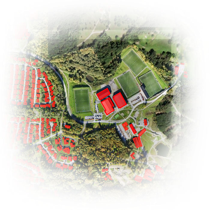
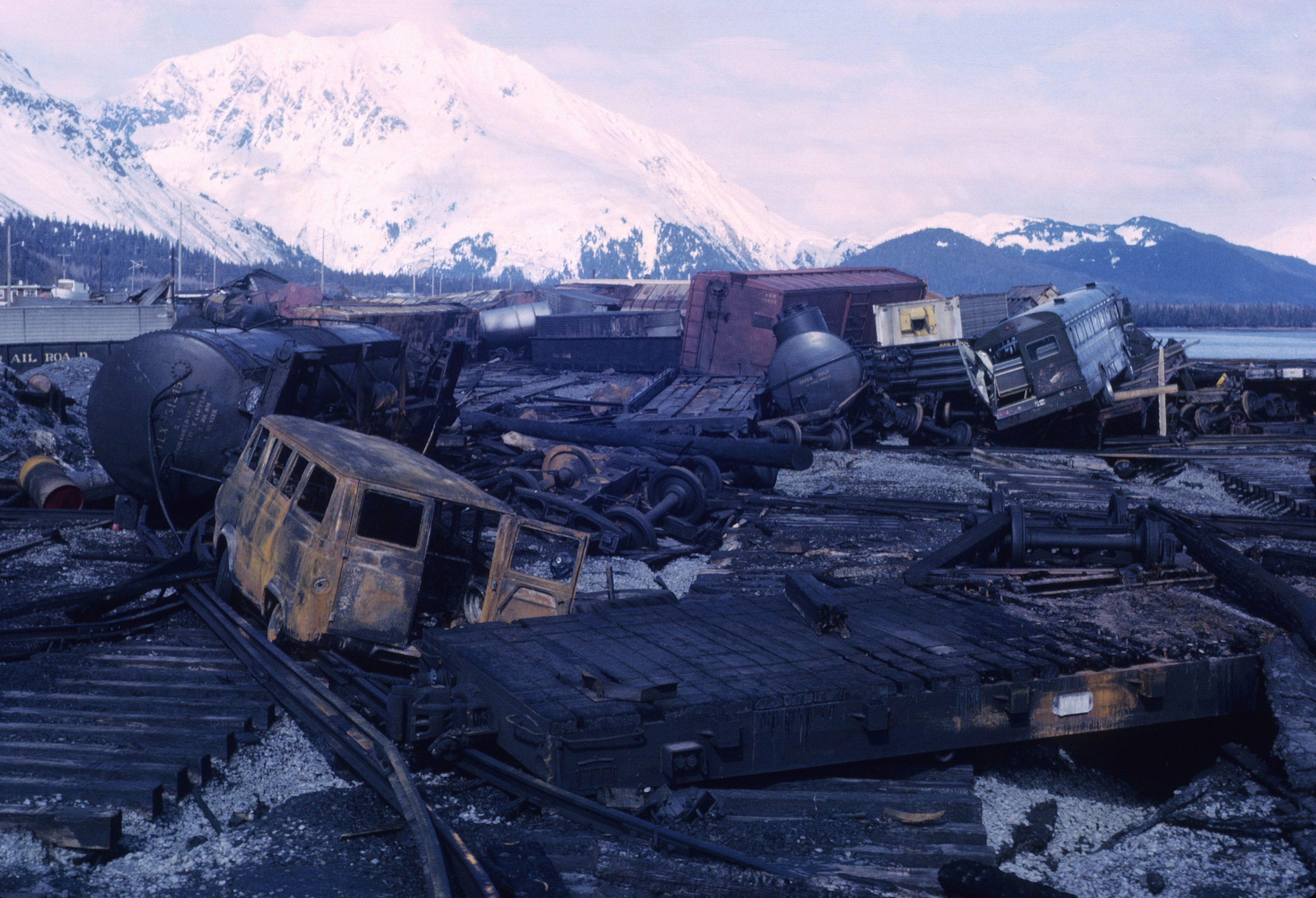
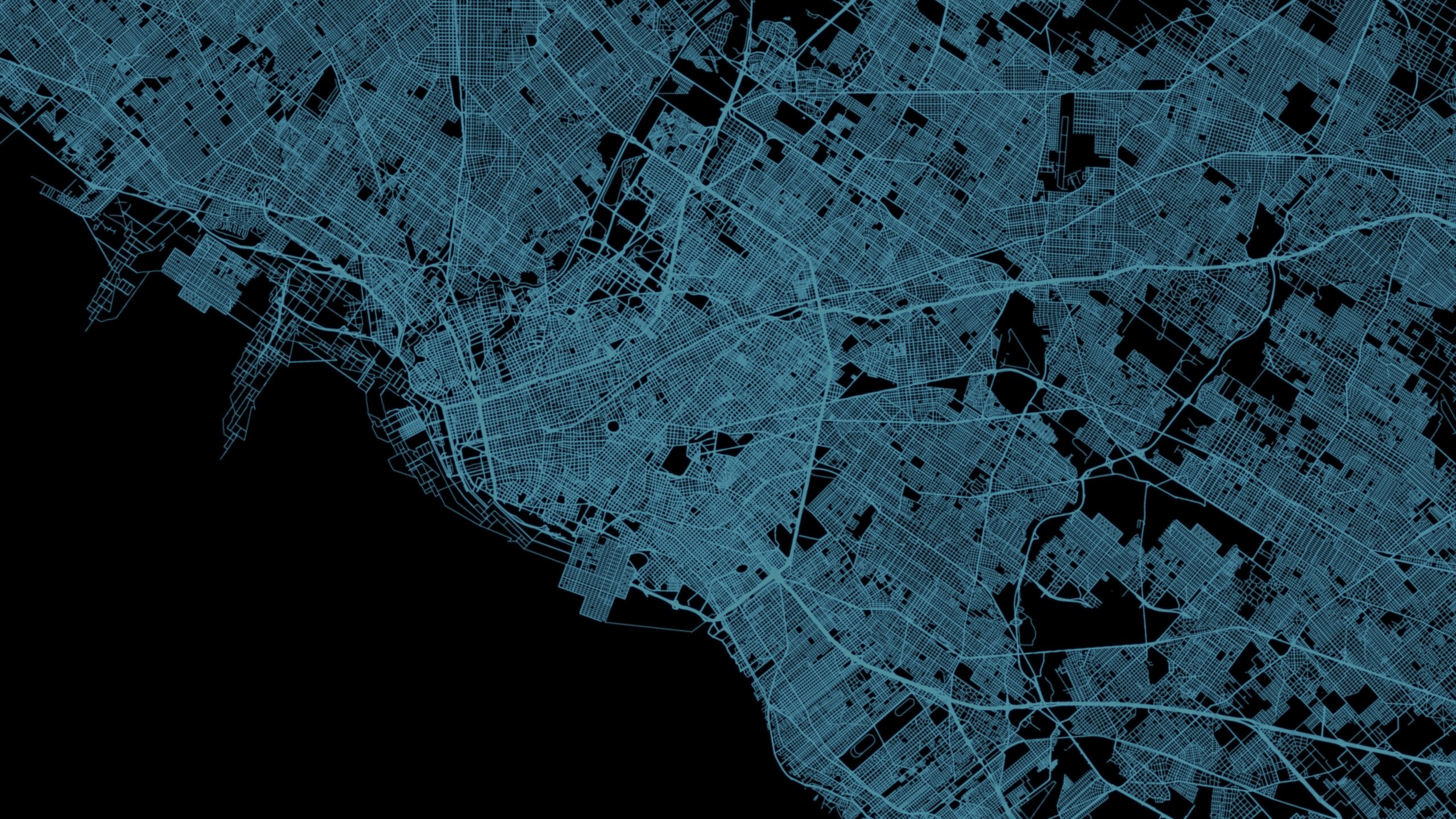
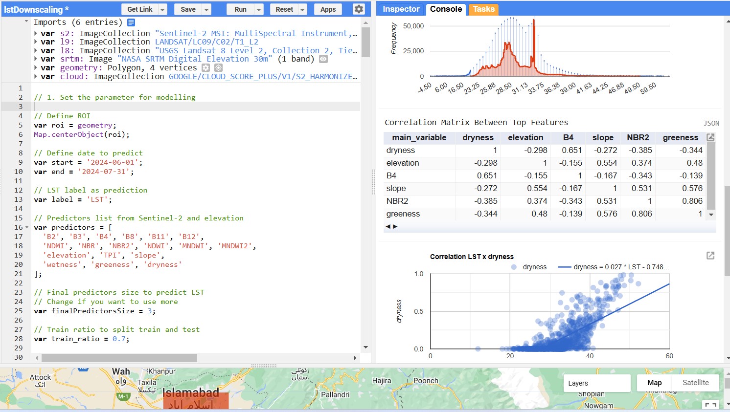
A small selection of recent projects


My research interests
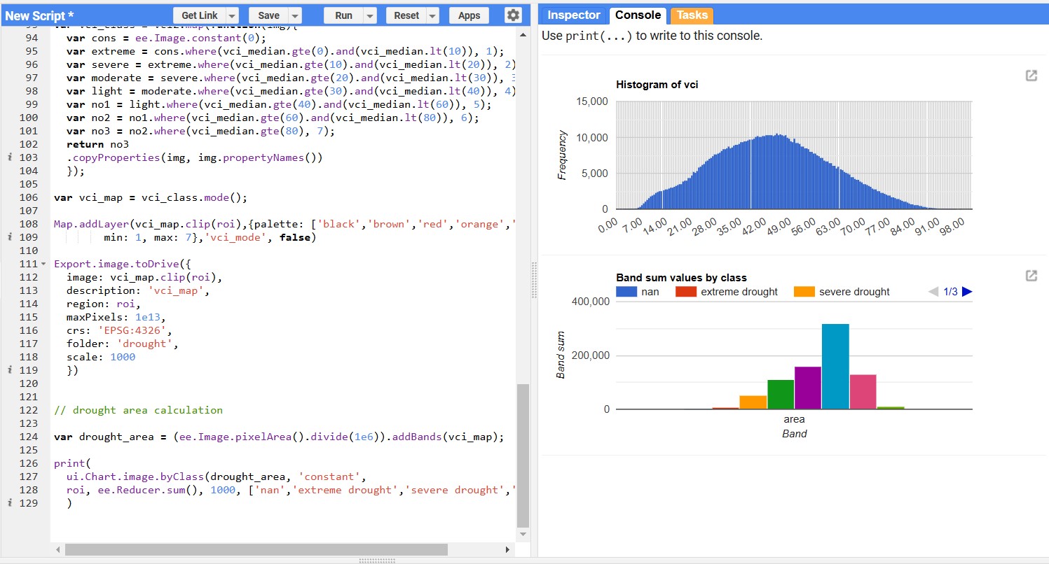
RS and GIS, Landscape Dynamics
Image Processing, Land Use Land Cover Change and impact assessment, Land Surface Temperature Dynamics, Floods impact assessment.
Mineral Exploration and Geology
Geological Mapping, Geochemistry, Remote Sensing, Mineral Exploration, Geophysics, GIS and Spatial Analysis.
Natural hazards and disasters impact assessment and mitigation
Computational Hydrology, Simulation and Geospatial Modelling, Floods, Landslides, droughts, temperature and other extreme weather events.
Spatial Data Science, GIS Development
Modern GIS (Programming Languages such as python (pandas, pytorch, yolo, geopandas, hypercoast, hyriver, geemap, leafmap, gee python api), javascript (leaflet, openlayers, arcgis js api, mapbox, react/next js), asp.net


Dr Javed Iqbal
Professor at IGIS NUST
Collaborating with Ahtsham was rewarding, as his professionalism, responsiveness, and dedication to research in machine learning for landscape dynamics, along with his enthusiasm for remote sensing and GIS programming, make him an excellent addition to any team seeking rigorous analysis and innovation.